1859 Ordnance Survey Map of Arbroath
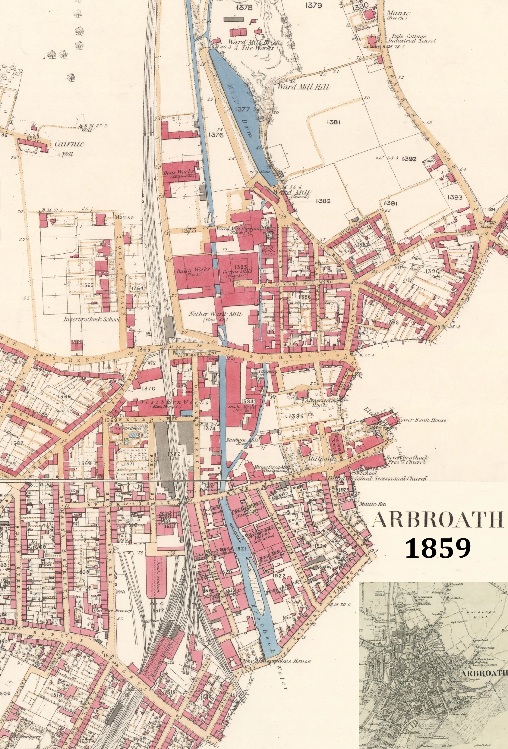
Composite of Ordnance Survey Map, 25in to the mile, surveyed 1859, showing the new northern area of Arbroath.
Upper Section (CC-BY-NLS)
Lower Section (CC-BY-NLS)
Inset: Map, 1:10560 scale, showing whole of Arbroath at similar time.
Publication
Map
Date
Source
CC-BY-NLS
Link