Thames and Severn Navigation
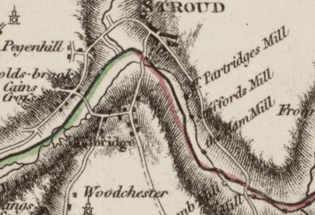
Robert Whitworth's map of 1785 shows the routes of the local canals that were important to the development of the area around Stroud during the industrial revolution. These canals linked the River Thames to the east and the River Severn to the west so that supplies could be brought in, and finished goods sent out, across the growing canal and river network to places far beyond Gloucestershire.
The Thames and Severn Canal from the River Thames to Wallbridge, Stroud is marked in red. The existing, Stroudwater Navigation from the River Severn to Wallbridge, Stroud is marked in green.
The Proposed Thames and Severn Canal, surveyed by Robert Whitworth 1785
PublicationMapDateSourceCC-BY-NLS Reproduced with the permission of the National Library of Scotland