Maps Of Arbroath in 1859
An Ordnance Survey map of Arbroath, surveyed in 1859 and published a couple of years later. By this time, Alexander Shanks had occupied "Dens Ironworks" on the northern edge of the town. Before this, in the 1840s, the correspondence address given by the business in advertisements was Oglivey Place which at the time was newly built, to the west of the railway heading north. Den Ironworks was on the opposite side of the railway.
A few years later, in 1863, Grimmond & Laird started selling mowers called "Mortons Patent." Their works was located at the "St Catherine's Engine Works" in St Catherine's Street Arbroath.
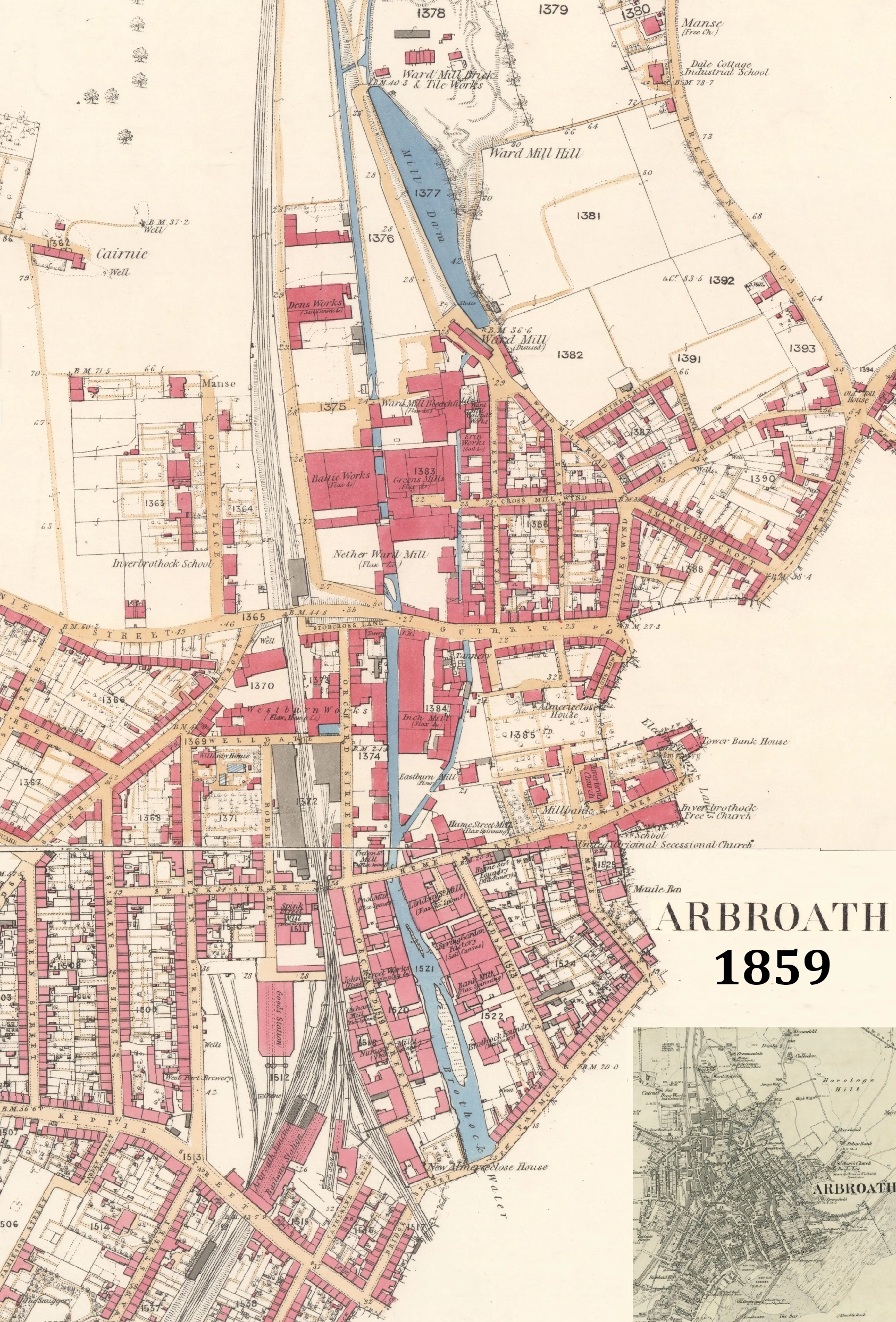
Composite of Ordnance Survey Map, 25in to the mile, surveyed 1859, showing the new northern area of Arbroath.
Upper Section (CC-BY-NLS)
Lower Section (CC-BY-NLS)
Inset: Map, 1:10560 scale, showing whole of Arbroath at similar time.
PublicationMapDateSourceCC-BY-NLSLink